The Name of Korea originated in Goryeo Dynasty (918~1392). The oldest atlas indicating Korea which refered to Corea on the map.
Having secured a job for one or two months in south korea back in 2007, i found myself in Samsung Shipyard on Geoje island and for the next ten years, i moved between the three biggest shipyards in the world.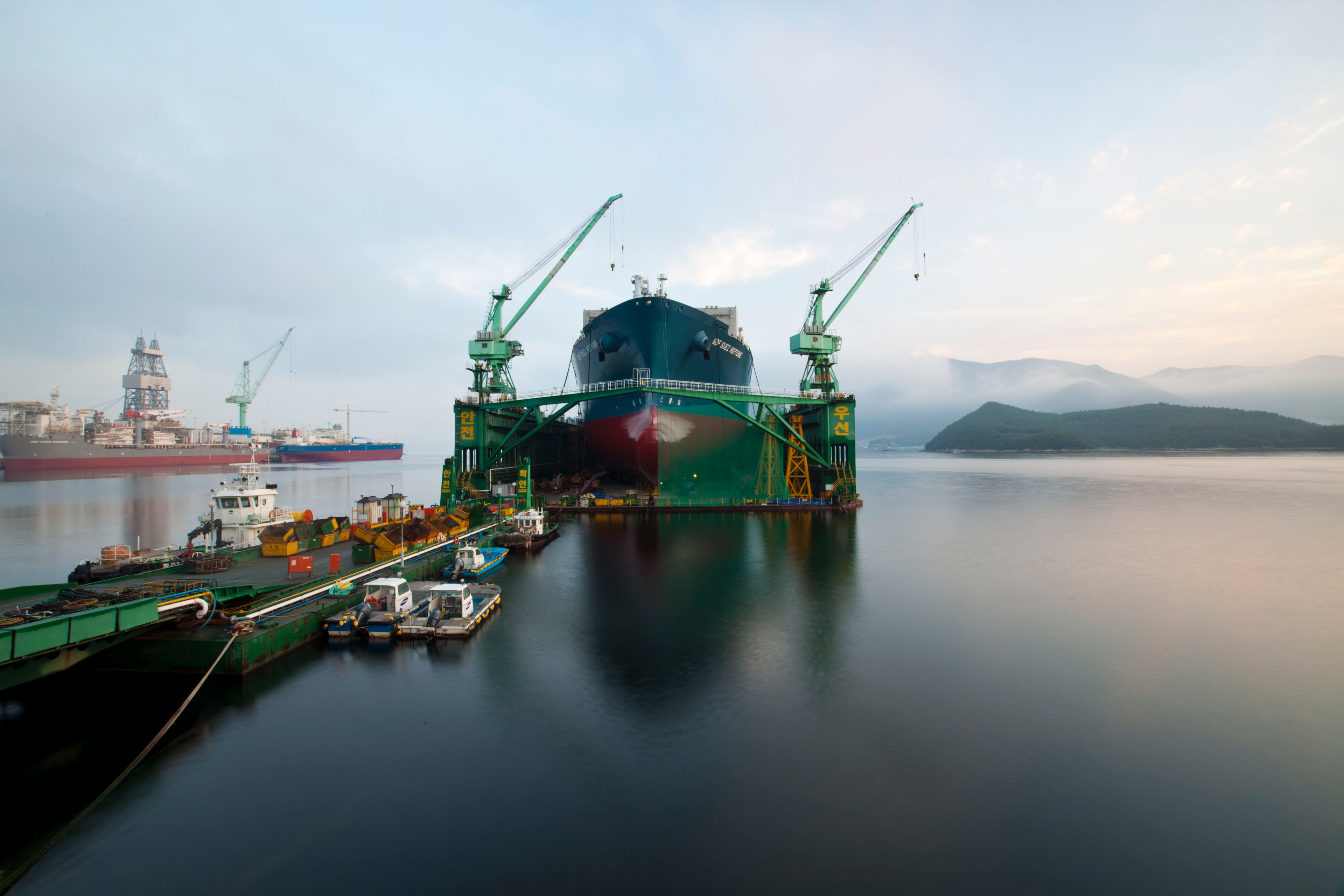
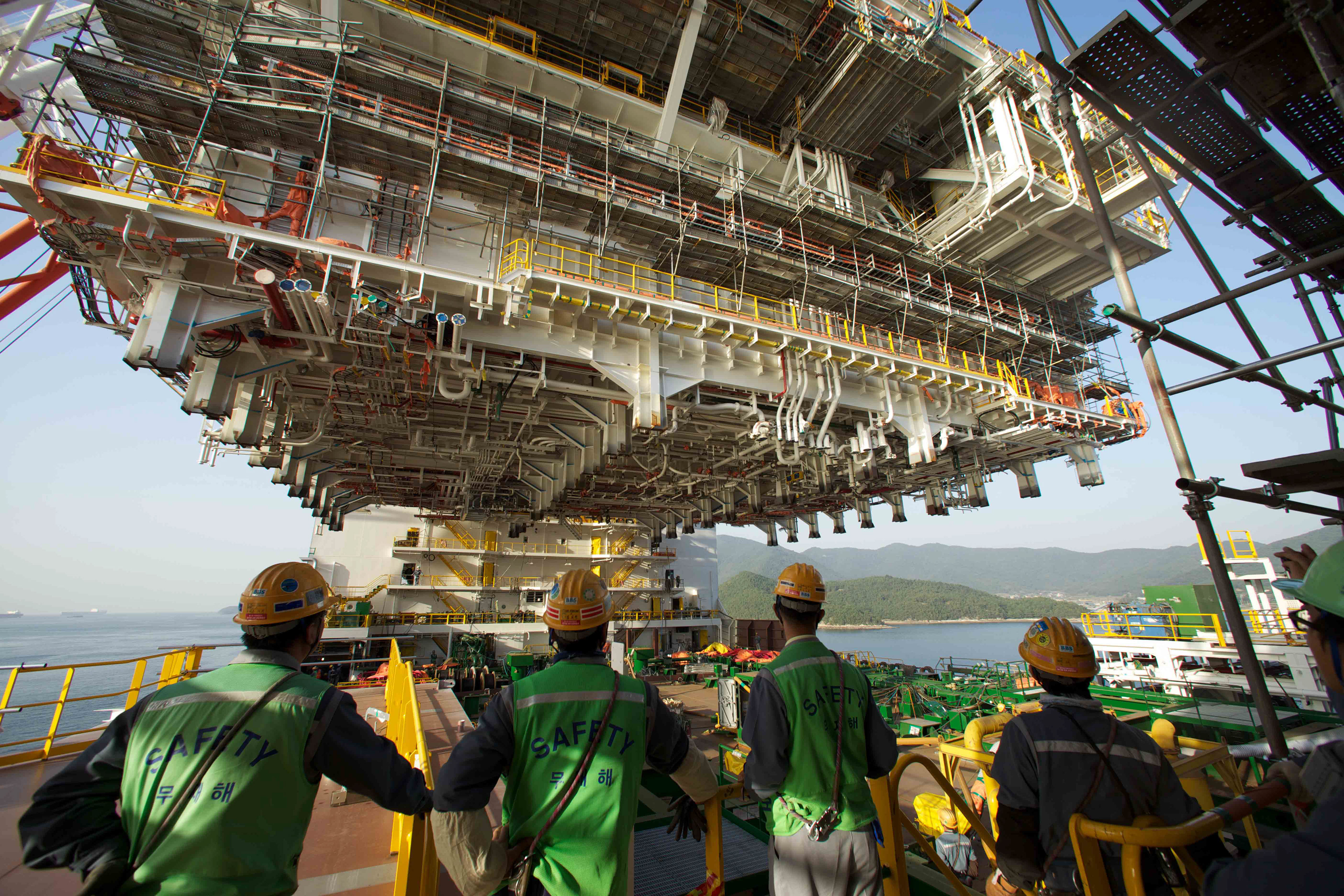
It was only then, that a previous passion for film photography opened up with the advent of digital photography for me. I watched a rig going from a drawing to a piece of steel, to a structure, to a fabulous 6th generation drill ship, capable of staying at sea for years, while drilling for oil or gas. I saw a nation take great pride in putting these rigs together in 18 months, from start, through installation and into commissioning. Many days in my time there, i saw huge parts of ships or engines, pass over my head on the way to their blocks and i gazed in wonder at how they organized everything.

Back in 2007, it was boom time for ship and rig building and the small town of Okpo, exploded into a huge overcrowded town, with not enough space for people to live in. There was no connection to the main city of Busan, except via a 2.5hr drive. Getting there from Europe was a nightmare, as you flew into Seoul, changed airports and flew down to Busan, then took the long drive to Okpo
Geojedo or Geoje Island (also often spelled Koje Island) is the principal island of Geoje City, on the southern coast of Gyeongsangnam-do province, South Korea. It is now joined to land by two bridges from nearby Tongyeong. Sinhyeon is the largest town on the island. The Busan-Geoje Fixed Link was open in December 2010 and provides a more direct connection to the city of Busan.
Geoje Island covers an area of 383.44 square kilometers (148.05 sq mi), the second largest island in South Korea (second to Jeju Island). The landscape features several peaks: Gara (580 meters (1,900 ft)), Gyerong (554.9 metres (1,821 ft)), the skirmisher mountain (465.5 metres (1,527 ft)), Daegeum (437.5 metres (1,435 ft)) and Googsabong (400 metres (1,300 ft)). Geojedo is known for its rich deposits of granite. The southern belt of Geojedo, together with part of Namhaedo in Namhae County, belongs to Hallyeo Maritime National Park.
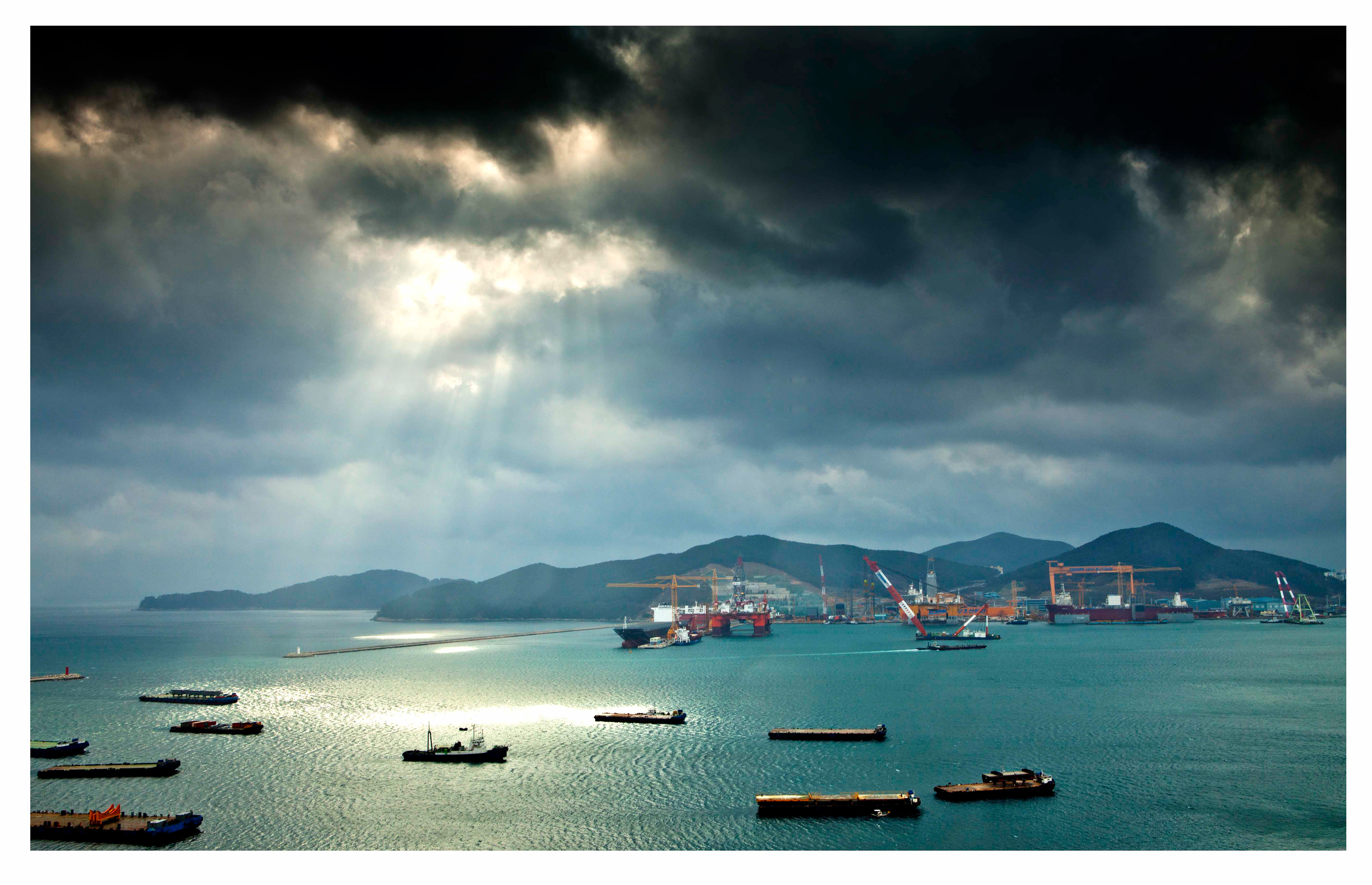
Geoje Island features several natural harbors. Shipbuilding is the largest industry on the island. The second and third largest shipyards in South Korea are both located on the island, Daewoo Shipbuilding and Marine Engineering (DSME) in the city of Okpo, and Samsung Heavy Industries (SHI) in the city of Gohyeon (Geoje City).
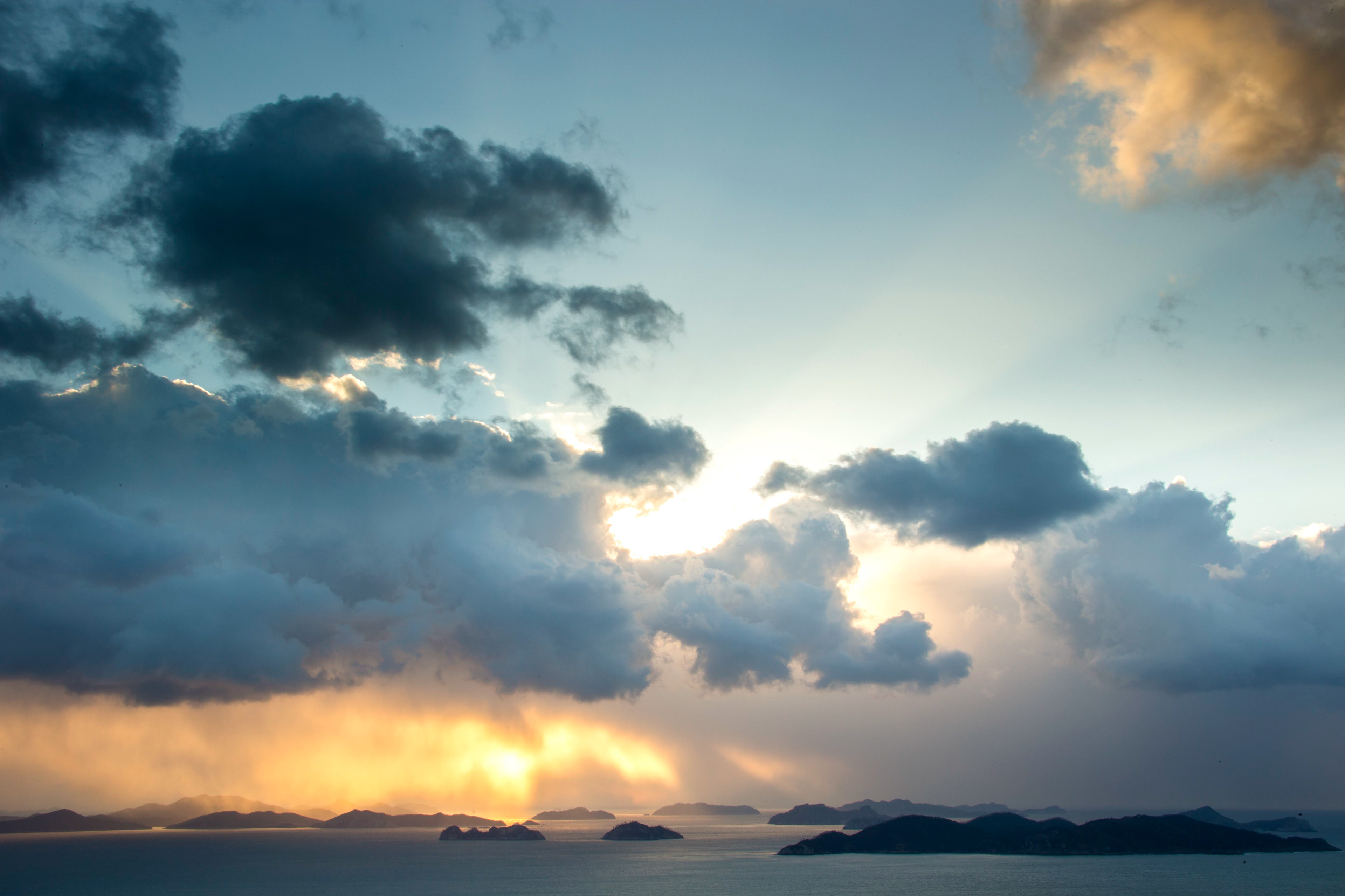
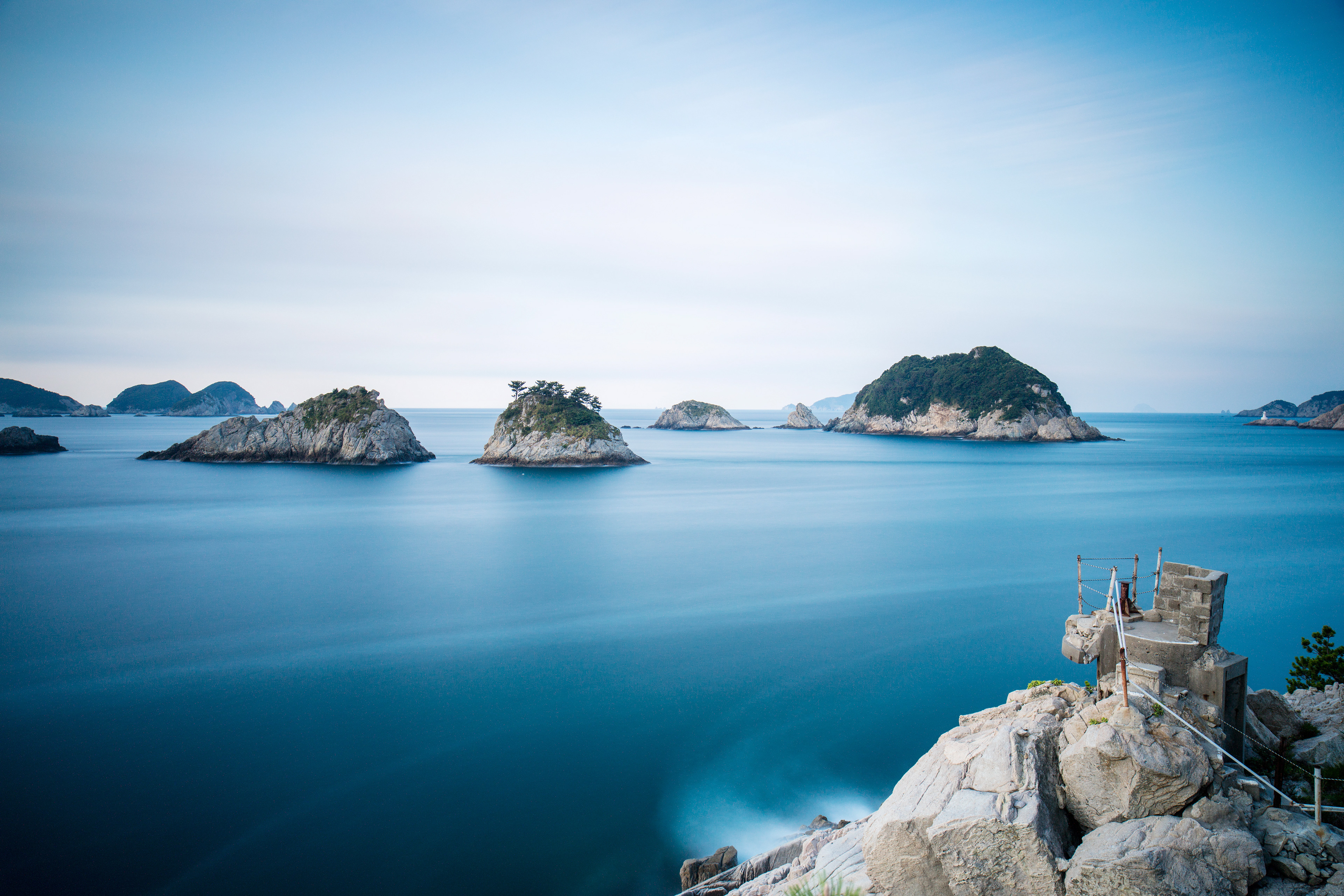
Geojedo Island is Korea's second largest island with breathtaking scenery. At Jangpyeong-ri, simply pass the great bridge and you will be led directly to Geojedo Island, which boasts the bulk of the South Sea's tourist attractions. Haegeumgang, Mongdol Beach and Oedo Island Paradise Island are the most popular sites among them. Haegeumgang, an island made of rocks, belongs to Hallyeo Marina National Park and is also called the Geumgang of the South Sea. It is famous for both its sunsets and sunrises, and its unique rock formations.
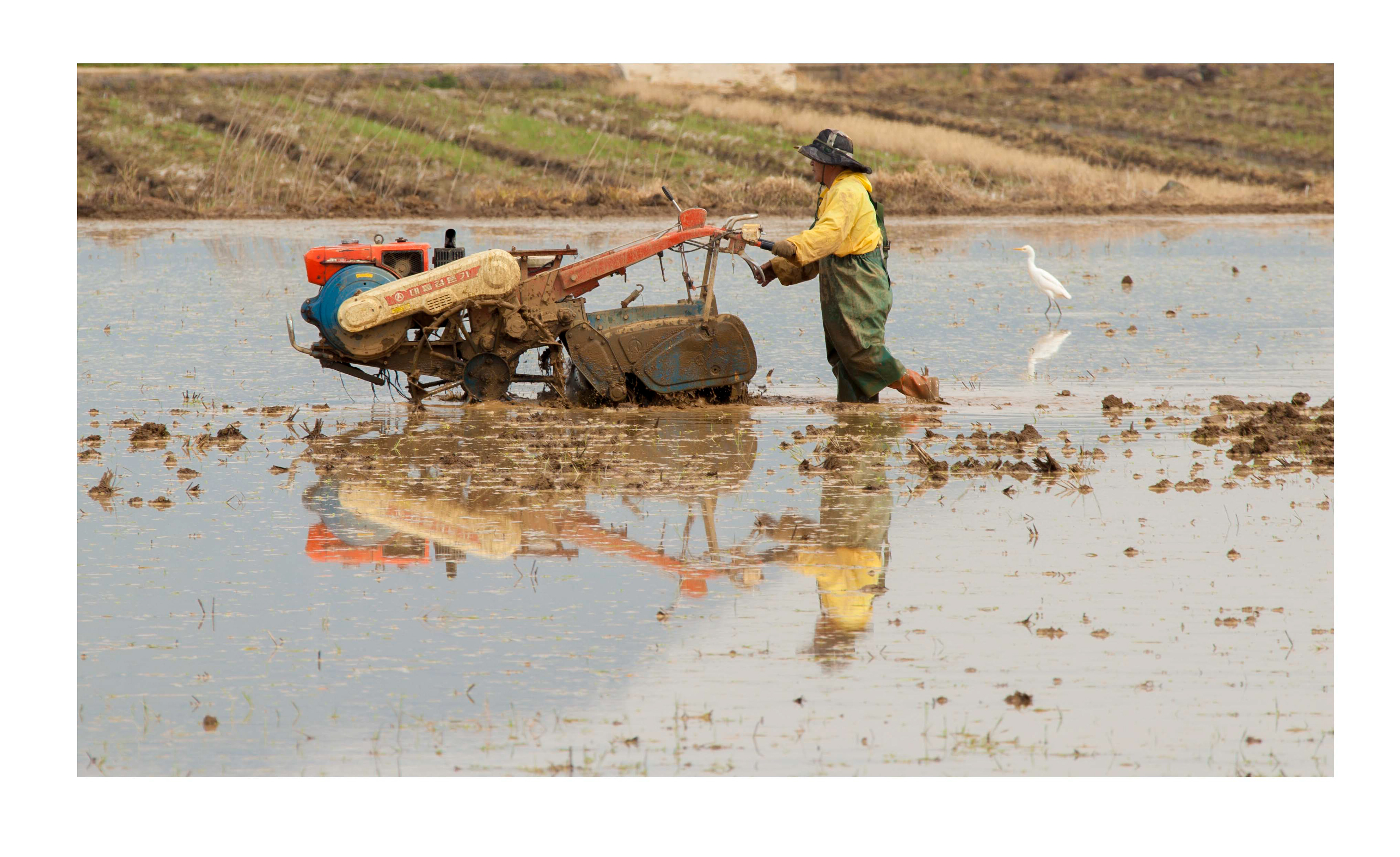
Back in the days before the bridge linked Geoje Island to Busan City, it was such a peaceful island, with people farming the land, almost the same as they have for the last 100 years or so. Paddy fields were planted by hand and soil was tilled by oxen or small motorized ploughs. Small colored villages and houses dotted the land and there was barely a sight of a multi story building outside of the bigger towns.
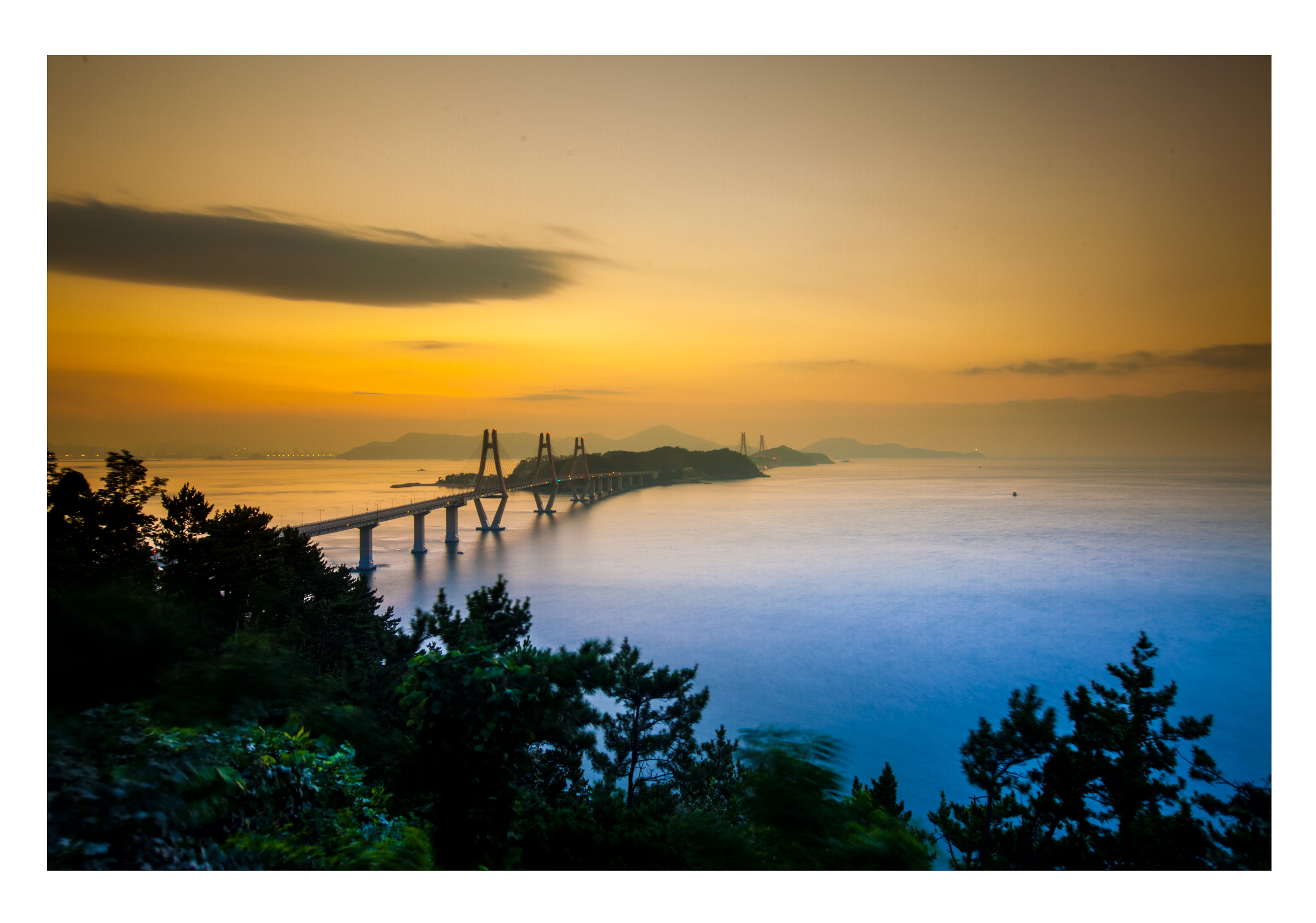
The bridge that brought Geoje island into this century, though id have preferred it never to have been built. I watched this road and bridge being built in the first 4 years i was there and it was an incredible sight. There was not a single day in that time, where the Koreans did not beaver away at the impressive road network, trying to meet their deadline.
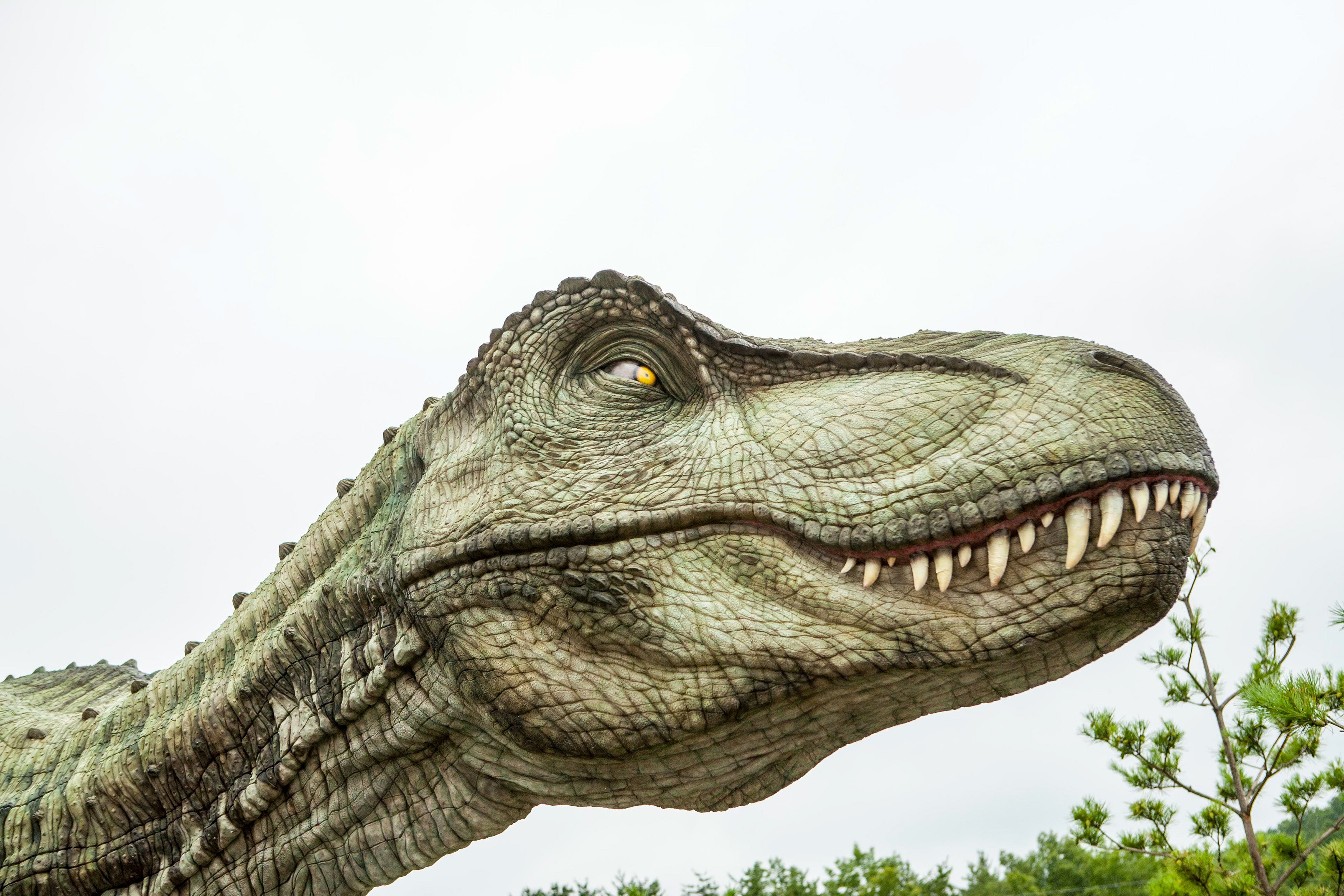
The sites of fossilized dinosaurs across the southern South Korean coast is a tentative UNESCO World Heritage site registered by the South Korean government in 2002. Fossils reveal that there were dinosaurs al over South Korea. The ancient remains of dinosaurs are located within a beautiful displays in various musuems and parks, that includes petrified wood, the tracks of extinct dinosaurs and other animals. Theseparks normally have life sized dinasaurs scattered throughout the park and if your a young kid, then they are great places to spend the day, pretending your being chased or eaten by these huge creatures.
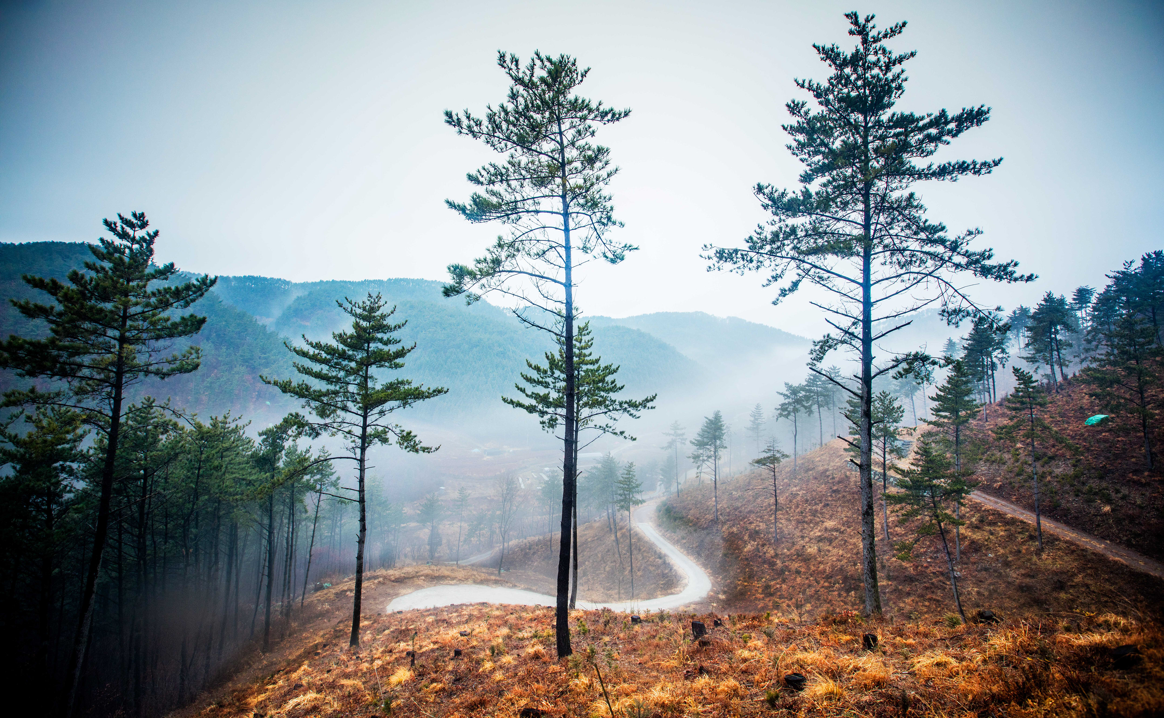
Under Japanese colonization in the early 20th century, forests were excessively overused and devastated. Besides the Korean War from 1950 to 1953 also caused more degradation of forests as the result of excessive cutting. The devastated forests led to serious social and environmental problems like lack of fuel, severe floods and droughts. Korea now has one of the best reforestation programmes in the world and the planting continues well into the future. within the forests, there are trails leading all over the island and its possible to traverse the whole of geoje, following these trails through the forests and overt he mountains. Though try and find a map to show these trails and its impossible as they worry about invading armies being able to go from place to place follwoing these maps? I looked for a map for over ten years and asked many people, but nothing exists, which is a bit strange.
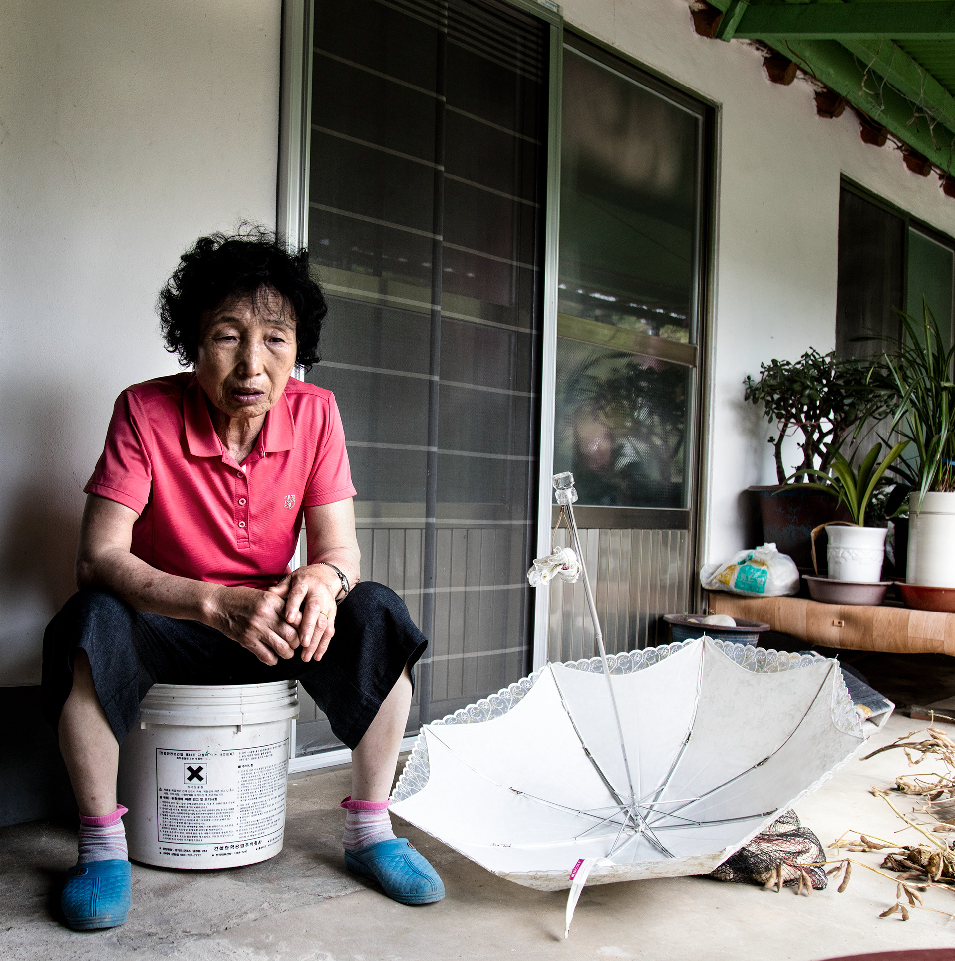
I travelled one day to a small island called Sandaldo, which lies of the south coast of Geoje island, where i worked. I travelled here to interview some of the residents for a local expat newspaper i was involved in. I met these two women and got to spend time in their houses. This island had no road to it, and only a ferry to get there a few times a day. These two women had lived and been friends on the island for over 60 years and had seen very little change on their island. That would change soon as a new bridge was being built and soon holiday makers would flock to it and buy land and build holiday homes, open coffee shops and like the rest of Geoje, the island would be deprived of its charm?
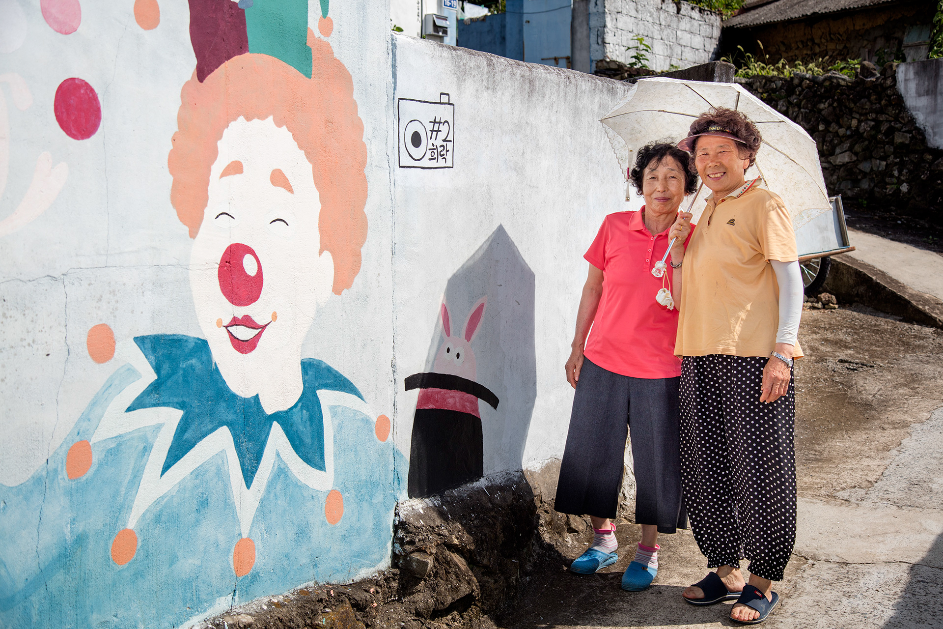
One of the women i met, took me to her small village house, and living there was tough, it was plain to see, but they were always so happy and now they could relax and sit around with the other islanders and discuss life while drinking Soju.
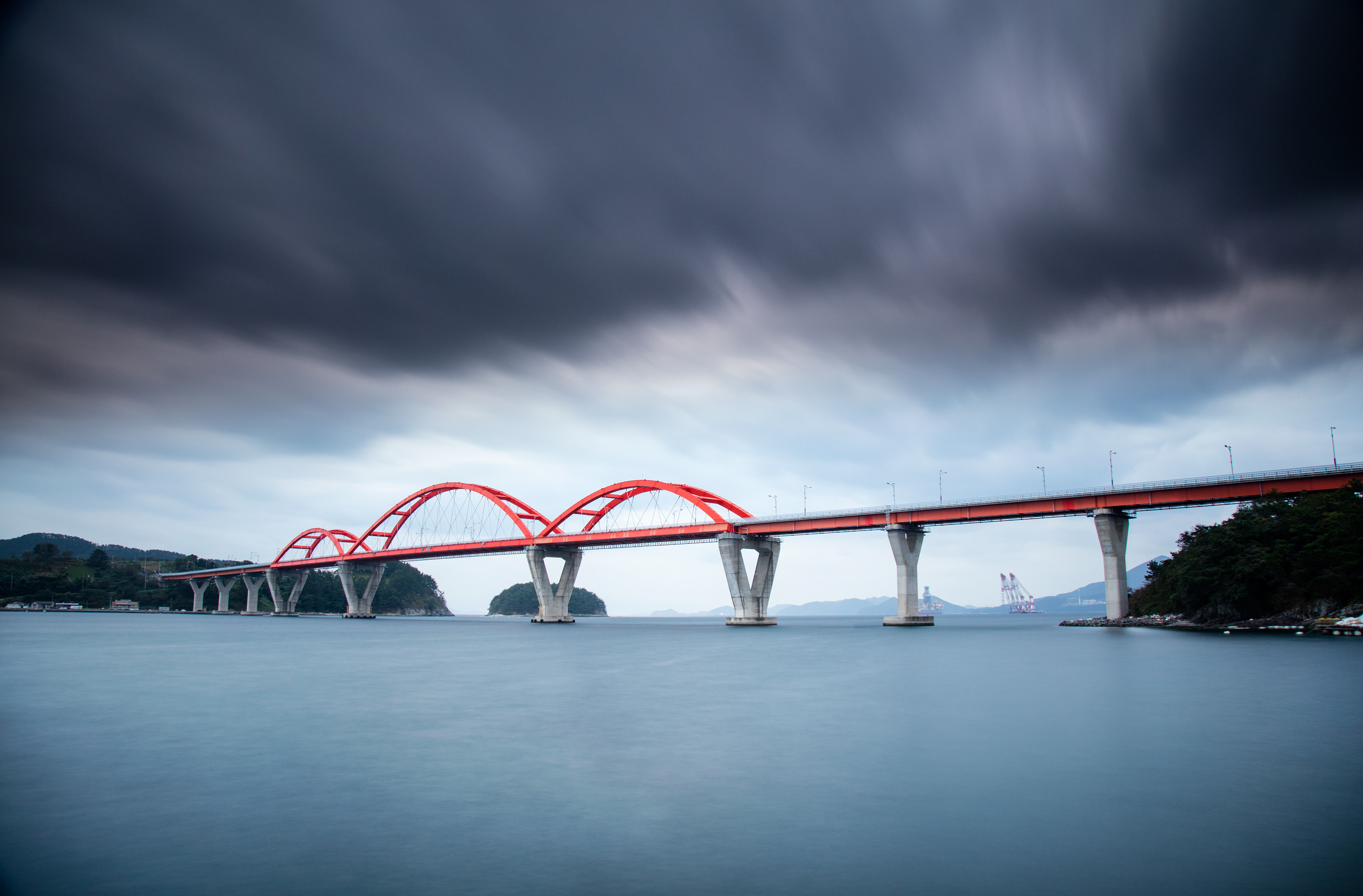
Around Geoje island, lies many smaller islands, which up untill recently, had only a ferry to get you there, but the Korean need to join the whole of the nation together, resulted in the building of some fantastic bridges to these small islands, to bring the people into the modern age.
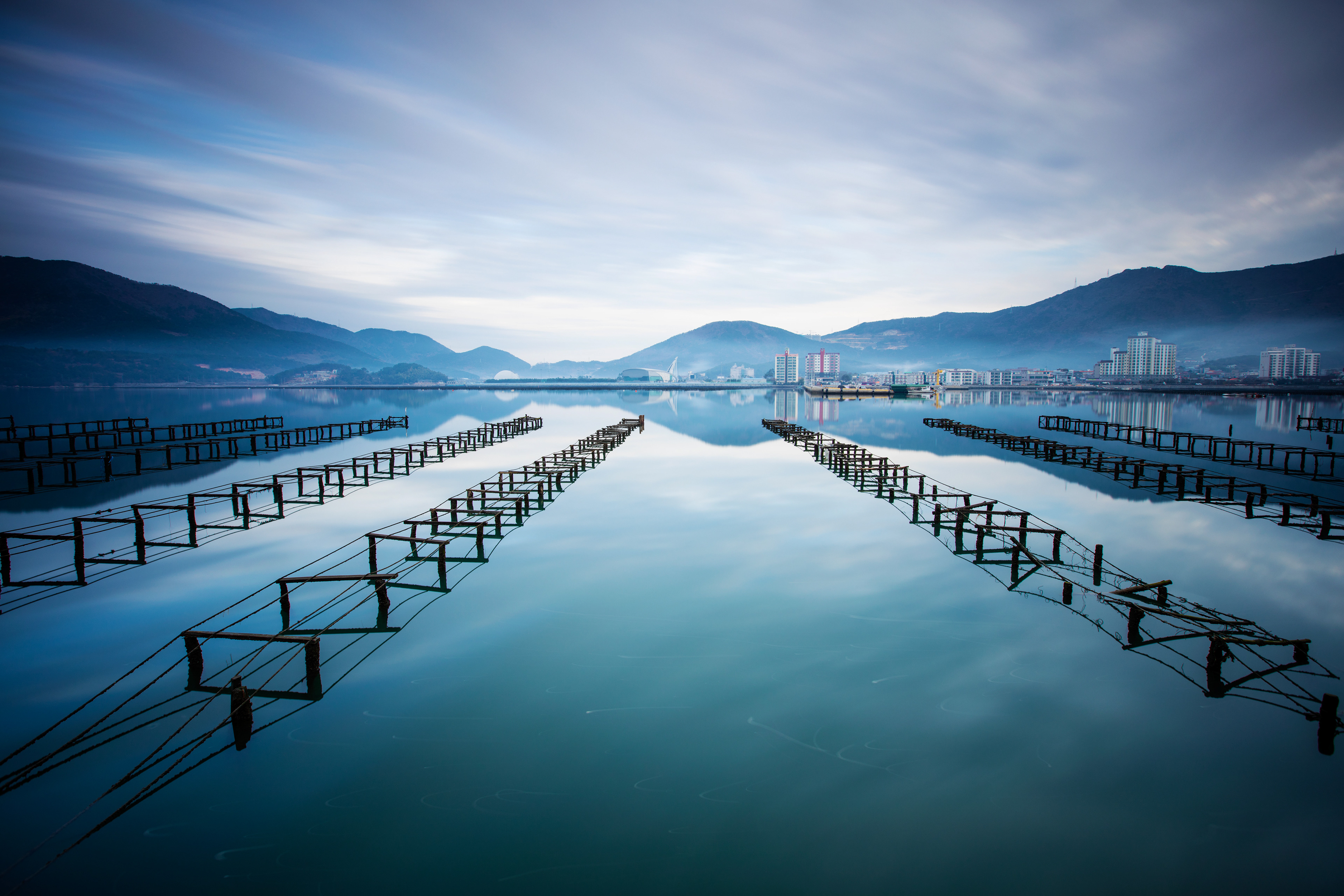
Oyster farms line the whole of the coasts line around most of korea, but they are especially prevalent around the coasts of Geoje Island. In this particular area, called Geoje Myeon, i spent a lot of time as the scenary and use of leading lines for these farms in my photography, made for some great images.
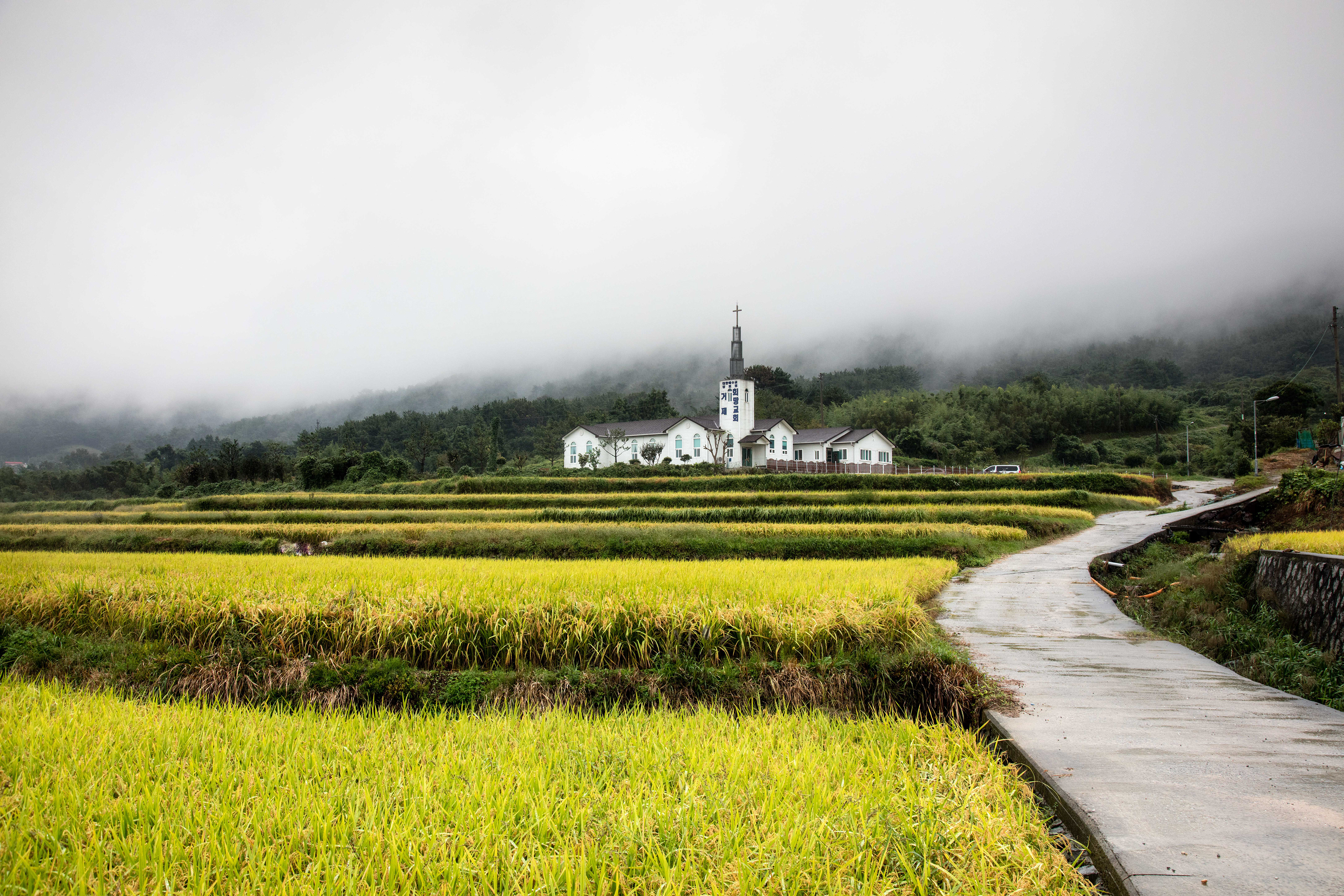
Churches now dot all of korea and as the nation has a high percentage of catholics, small churches spring up all over the place and can lead to some great addidtions to the landscape and as a landscape photographer, its allways nice to have a person or building in the frame to show scale.
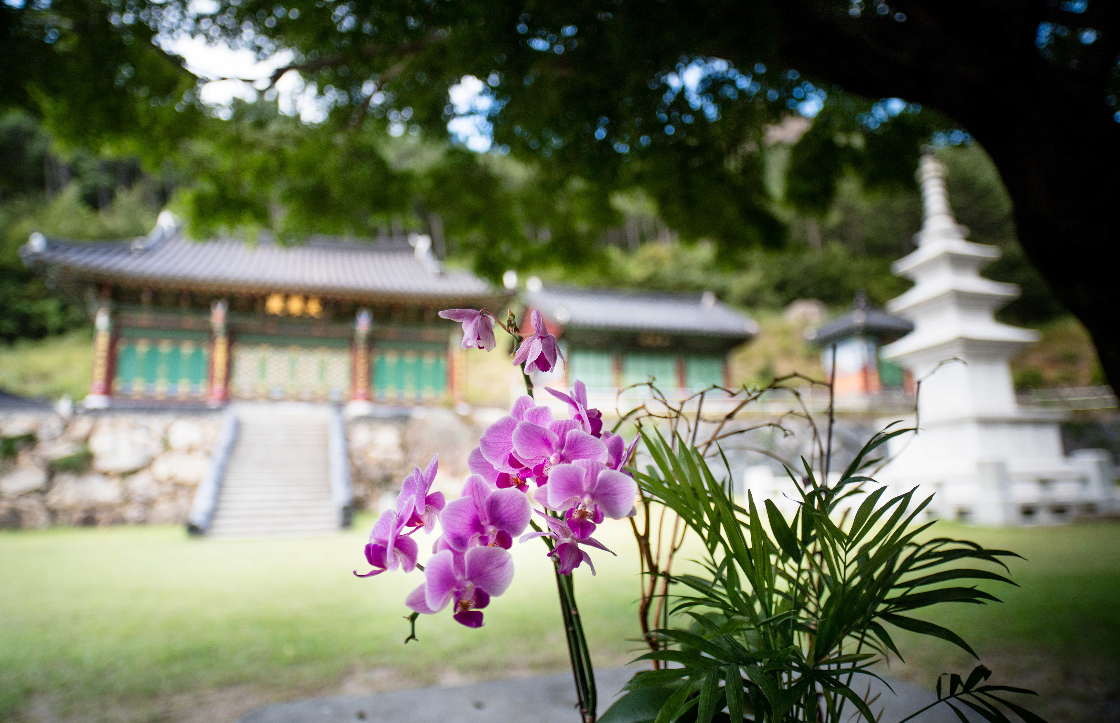
Temples........well these are absolutely everywhere and you need only explore for a short time on Geoje island, to find one. They are great places to go for photography, but they are also perfect places to find the calm after a busy or stressfull day at work. The older they are, the more peacefull they seem to be and i think any place that practices peace and serenity for so many hundreds of years, has a peacefull aura about it, that most people can pick up on. I visited one in Haenam, down in the south West of Korea and it was over 5000 years old, if i remember right. That will always be my favourite place, such was the energy there.
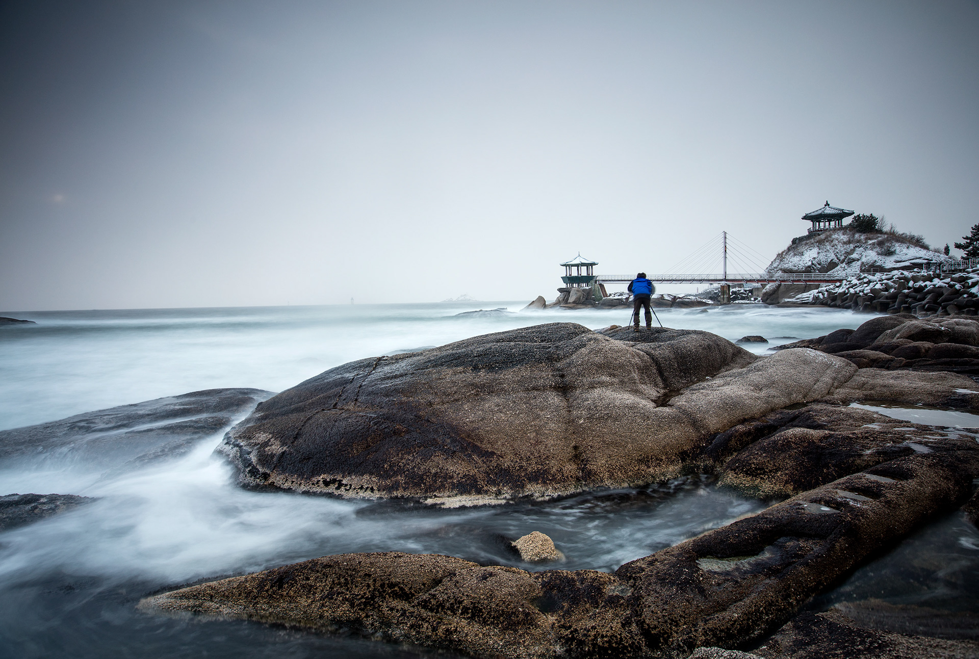
The landscapes offer such a diverse landscape especially around the northern coastal areas of Sokcho which are so rugged, untouched and beatuifull, though major roads are now being built into these areas ands progress will change it all. I was lucky i saw korea, when it was still just an undeveloped nation, which i fell in love with, but over the ten years, i saw its roads being built at a high rate and high rise building spring up at an alarming pace.
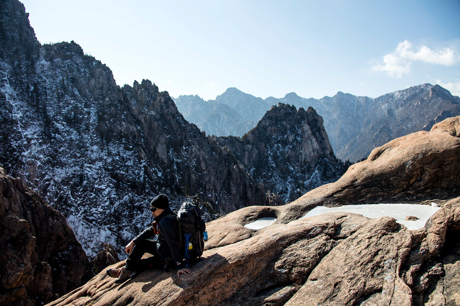
Seoraksan mountain region in the north east of Korea, has the most stunning mountains i saw in Korea and to get people to the top, they built a chair lift, which is typical of korea to build to make it easier for the people to get around.
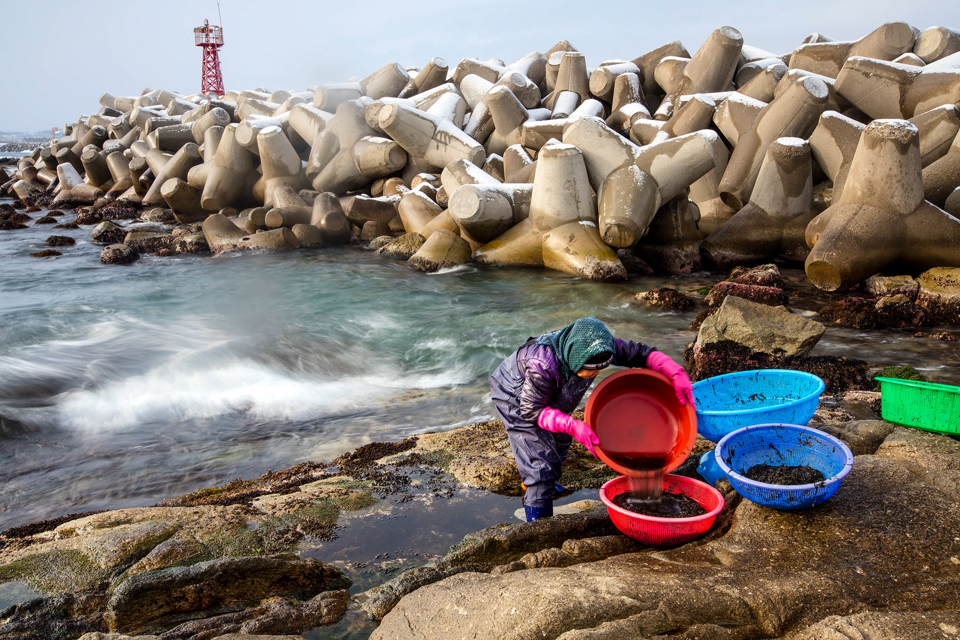
The nearer you got to the North Korean border, the more rugged the coastline became and the poorer the people seemed to be. There are 50 kms of fences on the way to the border, that shut off fabulous stretches of beaches. These woman i found in the bitter winds of a January morning, bringing seaweed out of the bitter cold sea.
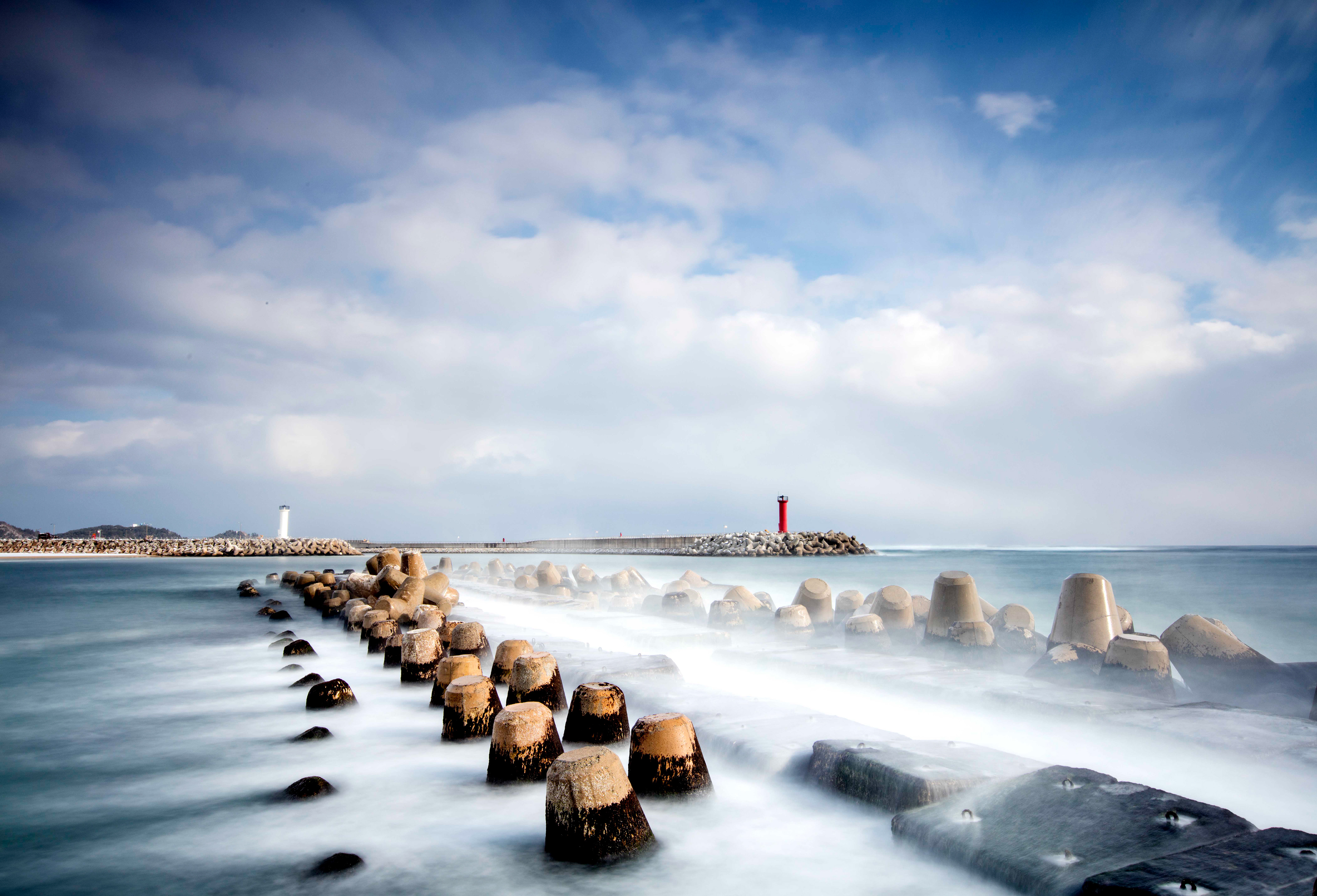
Sea defences near the north korean border, became more apparrent as i drove up the coast, but these provided a great addition to my landscapes and using a long exposure, i can add peace to the scene
I lived in Mokpo in the south west of Korea for almost two years and here is where my heart lies. I spent almost every weekend of that two years, driving around, finding new areas to explore and pushing my photography to new levels. Jindo island nearby Mokpo, has to be one of the most spectacular islands i have ever seen and i was in awe of the big skies, the thousands of islands and the stunning skies. I miss this place, like i would someone who has died and left me, and one day i hope to return, but i know in my heart, it will never be the same and i will not find the peace there as i did once before. In the mean time i will look at the memories i have and smile that i was there before it becomes ruined with travellers living their instagram lifes.